Closed
 Open
Open
High-Tech Partnership Elevates Snow Science at Brundage and Beyond
 Skiers and snowboarders at Brundage Mountain Resort may not know it, but they benefited from more accurate snow reports and improved on-mountain conditions this season, thanks to a new high-tech weather station installed in partnership with Boise State University.
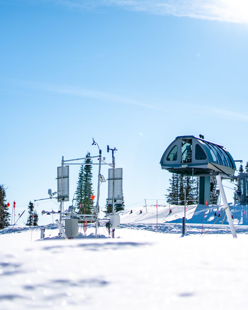
The new scientific-grade weather station, which came fully online for the 2024/25 season, is located near the top terminal of the Lakeview Lift. It collects precise data on snow depth, snow water equivalent, wind speed and direction, solar radiation, snow and air temperature, relative humidity, pressure, and other critical variables.
All that data answers pressing questions for powderhounds: How much did it snow? How dry is the snow? What wax should I use? Should I expect to find wind drifts or wind-scoured slopes?
It answers even more questions for scientists: What are the snow temperatures? How much solar radiation is on the surface, how much is being reflected? How are the mechanical properties changing? How accurate are remote sensing snow products?
The weather station collaboration between Brundage Mountain and Boise State’s Cryosphere Geophysics and Remote Sensing (CryoGARS) group is already enhancing slope safety and avalanche forecasting, and more instrumentation will be added this summer.
“This project is a win-win,” said Hans-Peter Marshall, associate professor in Boise State’s Department of Geosciences and co-director of CryoGARS. “It provides robust data for our research, while Brundage and the Payette Avalanche Center gain access to more advanced (and expensive) weather technology than they had the resources for on their own.”
High-Powered Tech
Unlike standard solar powered weather station setups, the new station is powered by line electricity and connected via fiber internet, provided by Brundage. That allows for the use of Boise State’s power-intensive specialized instruments, such as seismic arrays and radar systems, which help researchers measure how well the snowpack supports weight, how much water content it has, and when melting begins – which is crucial information for hydrologists and water planners, and helps improve tools for estimating mobility in snow covered terrain for the military.
“We are growing our network of sites, as part of research funded by NASA and the DoD,” said Marshall. “We work closely with NASA on airborne and spaceborne remote sensing of snow, and with the U.S. Army Cold Regions Research and Engineering Lab on military mobility in snow environments.”
Real-World Verification
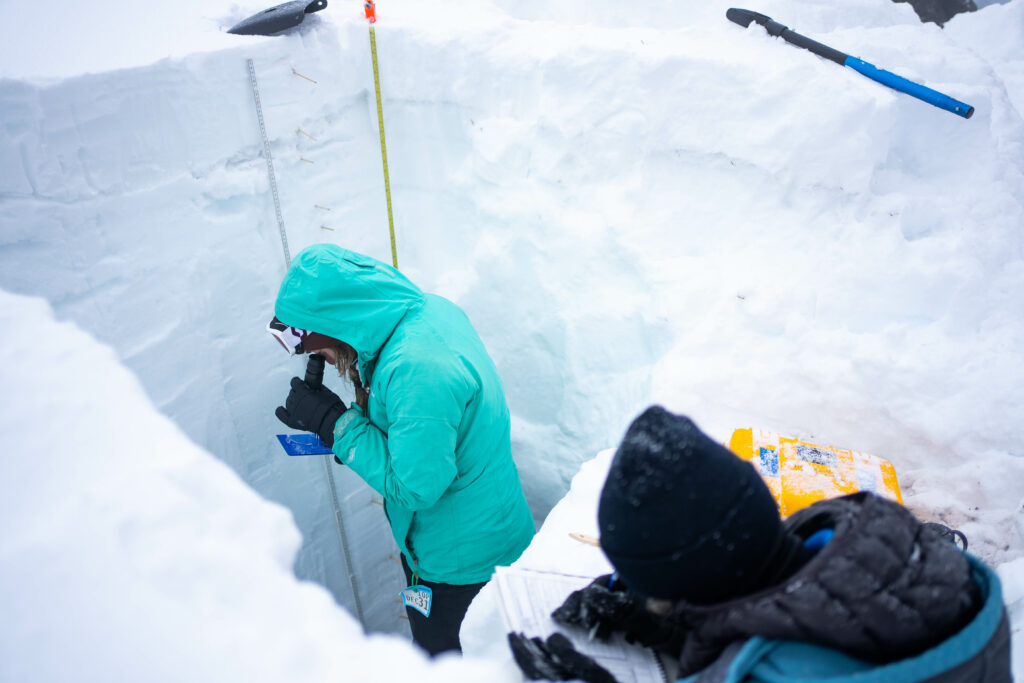
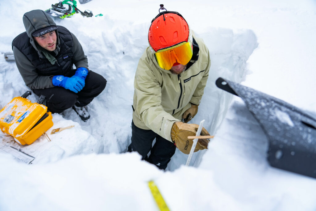 Installing the station was just one piece of the larger project. Boise State graduate students haul heavy equipment to the Brundage site every two weeks or so to perform manual snow science observations, cross-checking the automated data for accuracy. That’s where having chairlift transport becomes a huge asset.
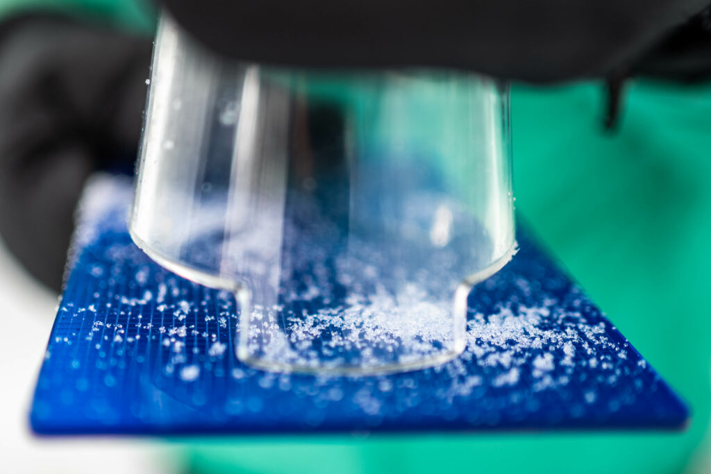
“We dig a full-depth snow pit and measure snowpack properties like grain type, density, temperature every 10 centimeters, snow strength, and the presence of free water,” said Coleman Kane, a graduate student at Boise State. “It takes about five hours to complete, but those manual measurements are crucial for validating the data we get from the station.”
Marshall said Brundage is an ideal location for this equipment. “We were looking for a site above 7,000 feet with internet, power, and access to deep snow. The partnership with Brundage makes it possible for us to test cutting-edge instruments that wouldn’t work at our solar-powered backcountry stations. We can test a wide range of tools, and then put the effort into reducing power consumption for more remote sites once we finalize the best techniques and instruments.” The site also provides a wonderful outdoor classroom for Boise State’s students who take Marshall’s Snow Science Field Methods course, which based out of the McCall Outdoor Science School (MOSS) for two extended weekends this winter.
Better Data, Better Turns
 While the new station aids in the pursuit of science, it’s also used in the pursuit of the perfect powder day. Brundage Mountain Patrol Director Janna Allen said the new weather station benefits Brundage skiers and riders in several ways.
“The data can help our grooming team adjust their timing and techniques to fine-tune snow surfaces across the mountain, and it gives our patrol team better insights for avalanche mitigation,” said Allen. “That makes it safer and easier for us to open avalanche-prone terrain like Hidden Valley and the backcountry areas within our permitted terrain, like Sargents.”
It’s also a huge asset for the Payette Avalanche Center, which now has more reliable, real-time information from a critical part of the forecast area.
On top of enhancing safety and slope conditions for skiers and snowboarders, the partnership between Boise State University and Brundage helps the researchers better understand how their data can be used day to day and from storm to storm.
As Marshall puts it, “This is a great example of co-production in research—engaging with the end users of data during the research process, rather than after. It’s also a great opportunity to support avalanche education and foster a deeper understanding of snow science.”
The data is now publicly available through the MesoWest network, providing access to researchers, meteorologists, and the public alike.